
EURONOTIAN Tate 1889
EURONOTIAN Tate 1889
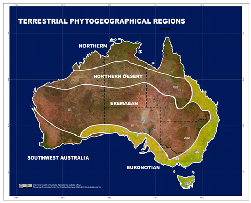
Tate (1889) defined the Euronotian as being “dominant in the south and east parts of the
Continent” (Tate 1889: 315), which he extended in his Rain Map to include northern and northwestern Australia.
Ebach et al. (2013) revised Tate’s region to include the Kimberly, Arnhem Land and Cape York sub-regions.
However, analysis by González-Orozco, Ebach et al. (2014) has shown that the definition of the Euronotian
is aphyletic and consisted of parts of three distinct regions (Northern, Eastern Queensland and Euronotian).
The Euronotian has been preserved as a senior synonym according to the ICAN and extended towards the
southwest to match the description of Tate (1889). The Euronotian now includes Adelaide Cracraft 1991, Eyre
Peninsula Cracraft 1991 and Hampton Ladiges et al. 2011, which were formerly part of the Eremaean Tate 1889.
There is currently no additional content associated with this term.