
ARNHEM LAND Cracraft 1991
ARNHEM LAND Cracraft 1991
Available Names:
Arnhem Land Cracraft 1991: 213.
Additional synonomies:
(Arnhem Crisp et al. 1995: 460), (Top End [in part] Bowman et al. 2010: 203), (Top End [in part] Ladiges et al. 2011: 33), Arnhem Land Ebach et al. 2013: 322
Area Taxonomy:
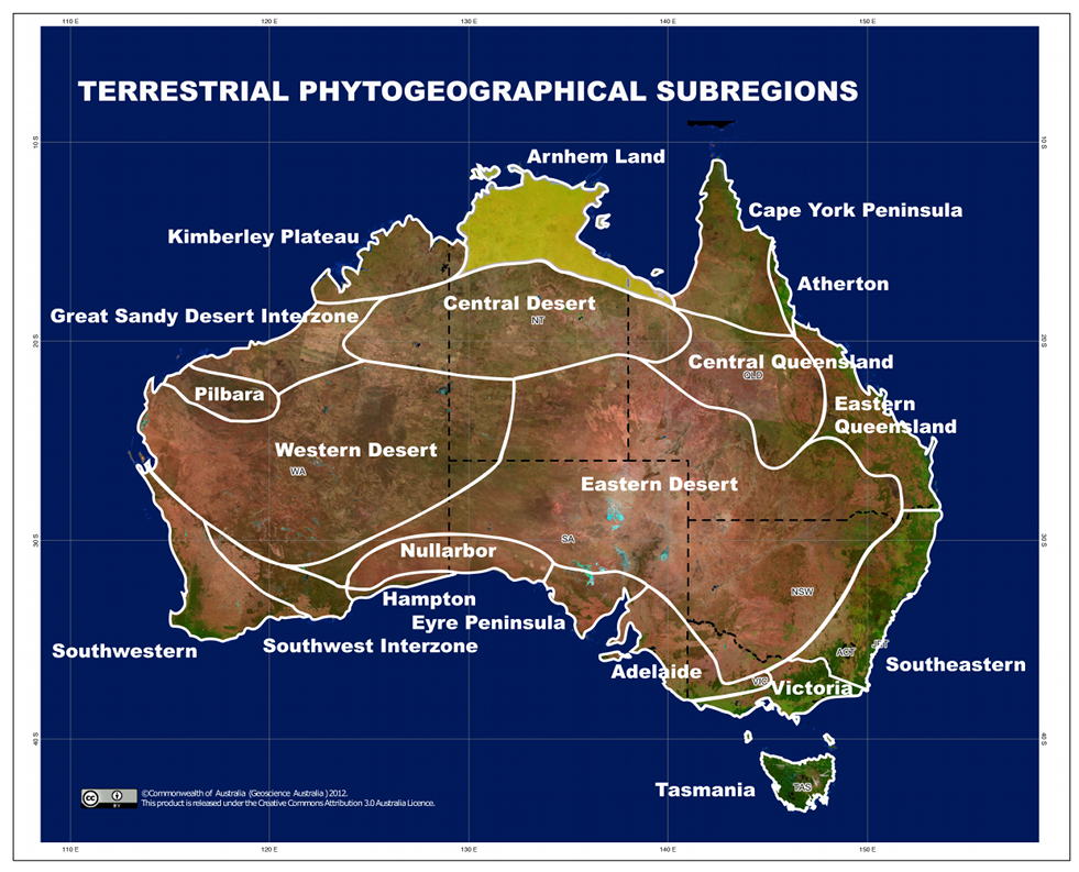
TERRESTRIAL PHYTOGEOGRAPHICAL AREAS
Sub-Realm:
AUSTRALIA (de Candolle 1820)
Region:
EURONOTIAN Tate 1889
Sub-Region:
ARNHEM LAND Cracraft 1991
Diagnosis:
The area west of the Leichhardt and Nicholson Rivers in Queensland, extending north between Carpentaria, Queensland to the Chamberlain River and Cambridge Gulf in Western Australia.
Type-locality:
Nourlangie Rock, Kakadu, Northern Territory, Australia, 12°52'1.10"S 132°48'40.14"E.
Ladiges et al. (2011) provided a concise definition for Cracraft’s Arnhem Land, however we confine its
eastern range to Lake Woods, Northern Territory, slightly altering the definition of Ladiges et al. (2011), which extends
considerably to the southeast.
Map:
There is currently no additional content associated with this term.