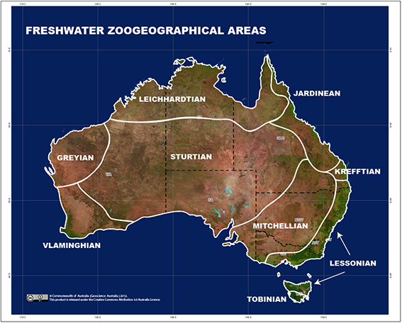
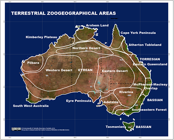
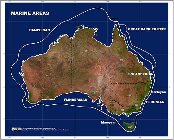
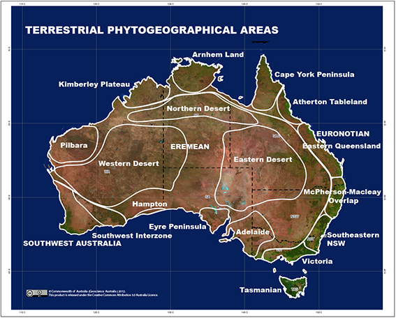
The Austral Bioregionalisation Atlas (ABA) aims to be a repository of all names and maps used to describe and depict phytogeographical, zoogeographical, freshwater zoogeographical and marine areas within the Austral Kingdom (Morrone 2015 Australian Systematic Botany 28: 81-90). Each area has a dedicated page that contains synonymies, a diagnosis, description, type-locality and a map of the area. Area names are synonymised according to the International Code of Area Nomenclature (ICAN) in order to distinguish it from other uses of the same term. For further news on further developments and updates, visit our blog.
Presently the ABA is limited to Australia and is taken from Ebach et al. (2013a) Zootaxa 3619: 315-342 [open access] and Ebach et al. (2015) Phytotaxa 208: 261-277 [open access]. Corrigendum (Ebach et al. 2013b) Zootaxa 3652: 299-300 [open access]. The phytogeographical sub-regions are based on an analysis by González-Orozco et al. (2014) PLoS One 9: e92558 [open access].
The ABA is funded by the University of New South Wales, Australia and supported under the Australian Research Council's ‘Future Fellow’ funding scheme (project number FT0992002).
![]()


